
Manville’s Unique Geography
Manville is the 230th largest town in New Jersey and is 1 out of 21 municipalities of Somerset. If you look at a physical map of Manville, you may notice that it’s North and Eastern borders are purely defined by a river, more specifically the Raritan River. Now typically rivers are seen as a blessing due to their economic benefit of sea transport of goods. Although the Raritan River provides power and drinking water, it also comes with a cost.
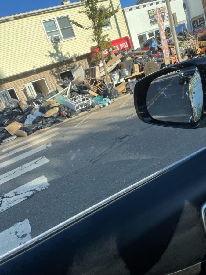
On September 1, Hurricane Ida hit Manville, and it showed all of Manville’s weak points. An area known as the ‘Lost Valley’ is known for extremely terrible flooding due to it being shown below sea level. There is also another river that goes through Southern Manville near the western area that is prone to flooding as well. It also happens to be that all major entrances and exit points were unassessable due to yet again being below sea level. While towns like Somerville and Bridgewater receive minor damage, due to half of the town of Manville being under sea level, damage exceeds millions of dollars.
Manville was basically shut down for a week after the initial hit of the most recent hurricane, however, this isn’t the first time this has happened. Hurricane Floyd and Hurricane Irene although less severe than the most recent one, gave a warning to our flaws. The NAOO suggested a plan to build a sea wall around Manville to prevent catastrophic flooding like this however nearby towns protest the idea due to the possibility of directing water to flood other towns. The solution for this issue still remains a problem to Manville’s survival as a small town. So until Hurricane’s decide to stop hitting, New Jersey’s Manville is going to have a tough time swimming above the water.
Xin Chào!, My name is Bill and I´m a Vietnamese freshman at MHS. During my spare time, I like to play simulation games and listen to music (specifically...